Watauga Lake Reaches Record Water Level
(a series of photos showing the impact of the record high water is available at the bottom of this page)
Scenic Watauga lake, which was built in the mid 1940's, was designed to control flooding of the Watauga and Elk rivers as well as generate electricity for the area. Although the spring months at the lake are commonly used to slowly raise the water from its lower winter level, 2013 would be different.
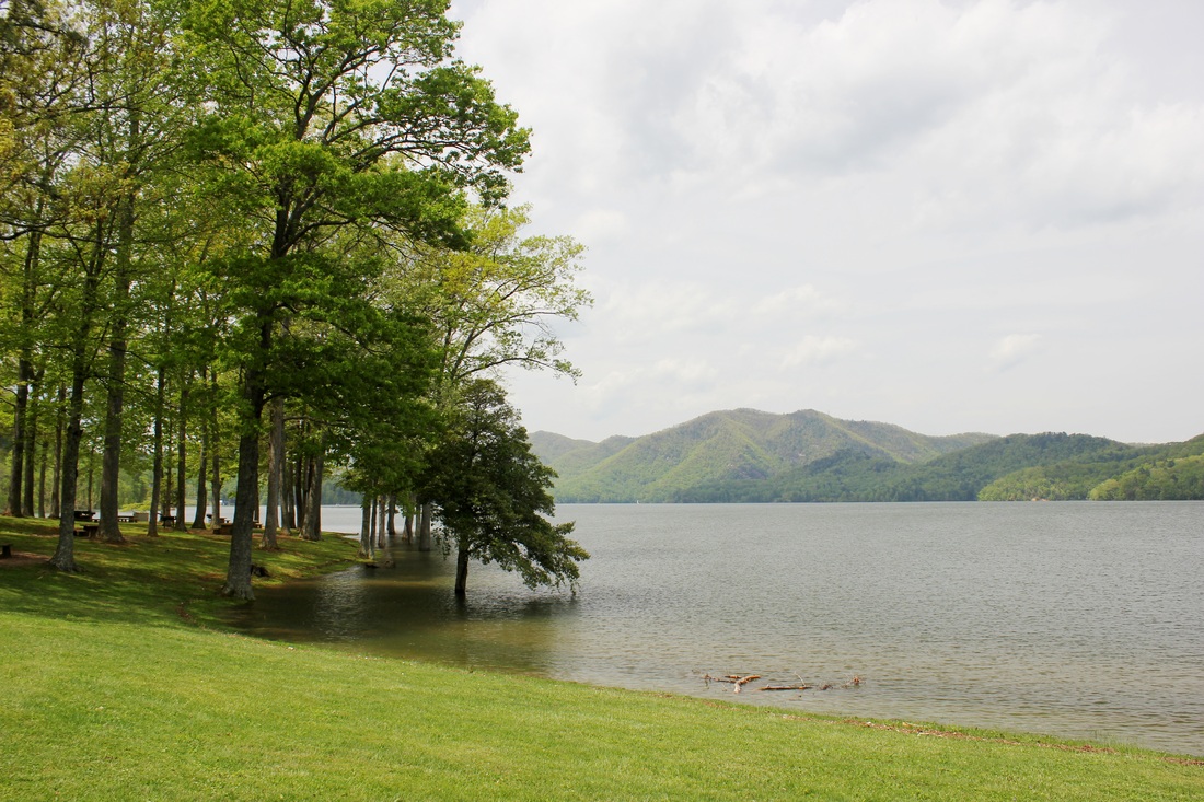
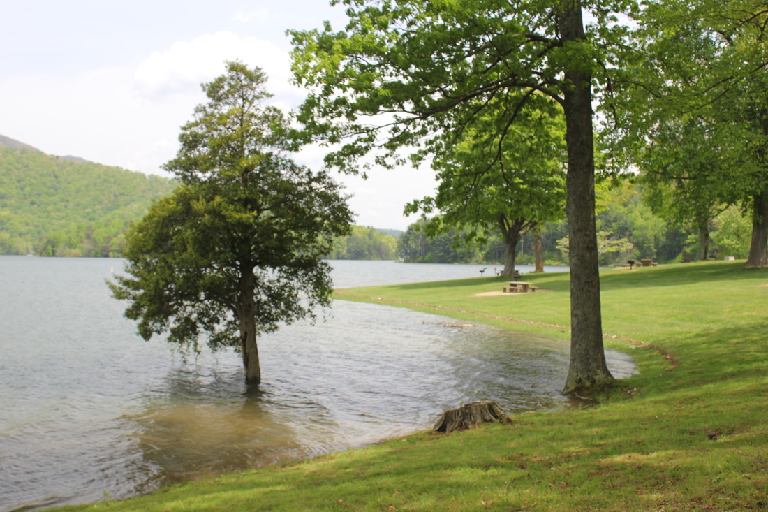
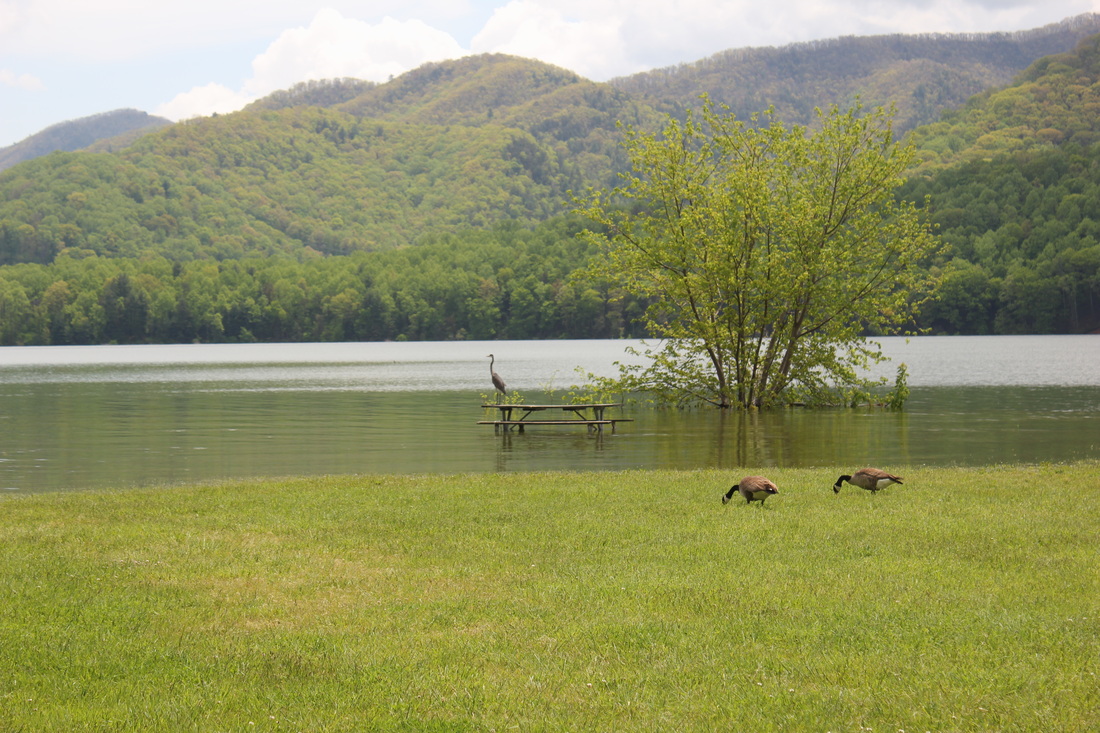
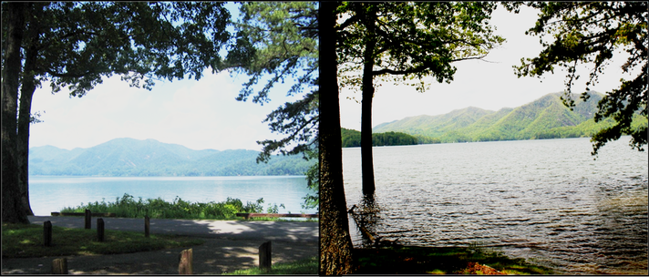
The below photo shows a picnic table at the Watauga Point
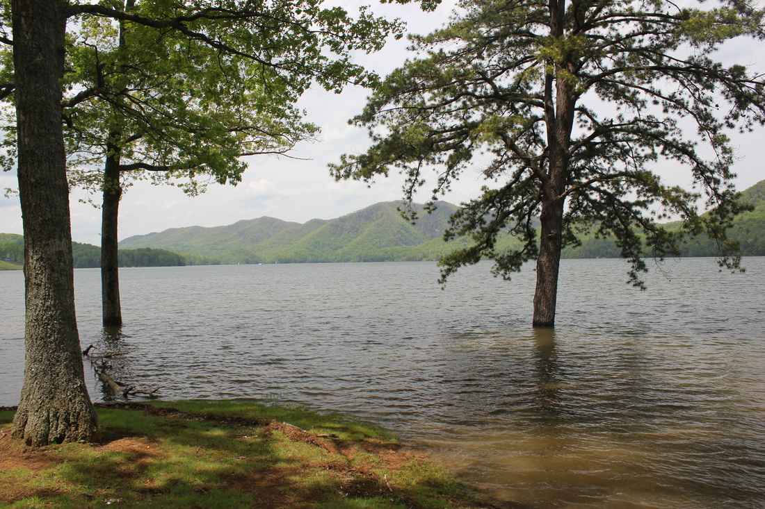
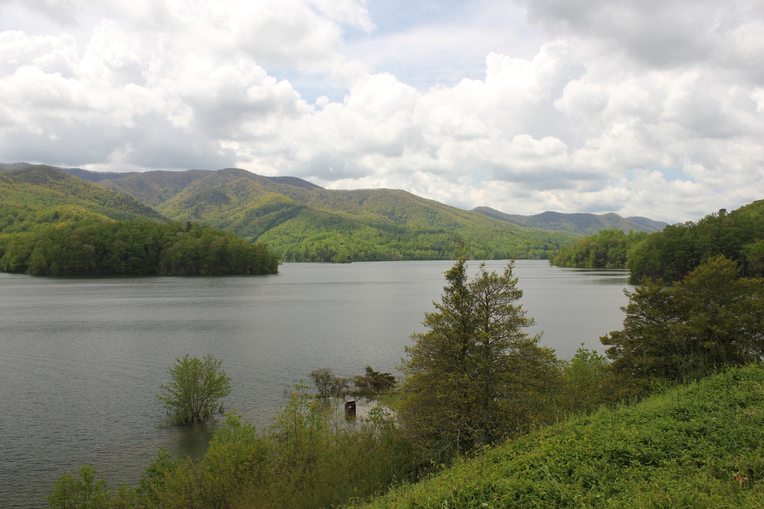
In May of 2013, the lake was pushed to its limits. The spring had already produced a higher than expected rainfall total. With a watershed that reaches as far away as Boone, North Carolina, several inches of rainfall hit the area northeast of Carter County and millions of gallons of water poured into the lake through its two main tributaries. The already full lake would raise several feet in a matter of just a few days setting a new record high water level of 1966.2 feet ASL (Above Sea Level). According to a Tennessee Valley Authority spokesperson, this was three feet higher than the previous record level that was recorded in 1987.
The TVA had to react immediately to begin the process of quickly and safely removing water from the lake with minimal damage to downstream structures. Ironically, one of the turbines used to generate electricity had recently been taken off line for scheduled maintenance. This turbine which can move more than 850,000 gallons of water per minute was not available and water had to be bypassed through a sluice that had been built into a nearby mountain. This sluice could bypass the turbines and dump water directly into the Wilbur lake. An underground pipe that extends longer than a football field feeds the powerhouse with ice cold water from the bottom of the Watauga lake near the dam. The water temperature is around 40⁰ Fahrenheit when it reaches the powerhouse. The pipe is capable of supplying around 2,000,000 gallons of water per minute to the powerhouse but even in this extreme instance, the gate was only opened to allow 25% of potential capacity to flow out of the lake at a rate of 545,000 per minute.
The TVA had to react immediately to begin the process of quickly and safely removing water from the lake with minimal damage to downstream structures. Ironically, one of the turbines used to generate electricity had recently been taken off line for scheduled maintenance. This turbine which can move more than 850,000 gallons of water per minute was not available and water had to be bypassed through a sluice that had been built into a nearby mountain. This sluice could bypass the turbines and dump water directly into the Wilbur lake. An underground pipe that extends longer than a football field feeds the powerhouse with ice cold water from the bottom of the Watauga lake near the dam. The water temperature is around 40⁰ Fahrenheit when it reaches the powerhouse. The pipe is capable of supplying around 2,000,000 gallons of water per minute to the powerhouse but even in this extreme instance, the gate was only opened to allow 25% of potential capacity to flow out of the lake at a rate of 545,000 per minute.
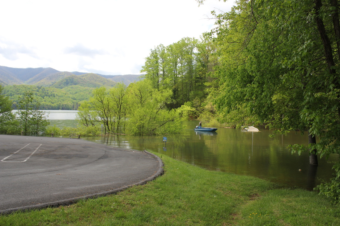
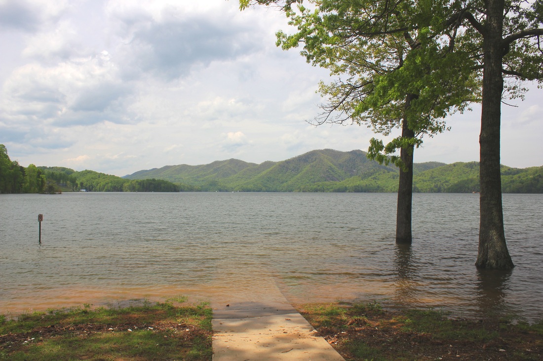
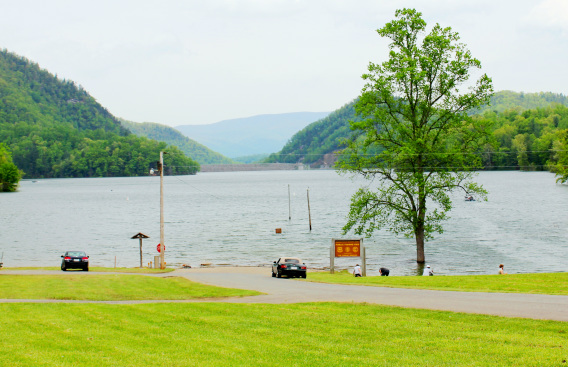
A flooded road at Watauga Point
The use of the bypass has created a river that flows directly through the powerhouse. According to TVA personnel, use of the bypass is such a rare event, that TVA officials have traveled to the area to experience the event first hand.
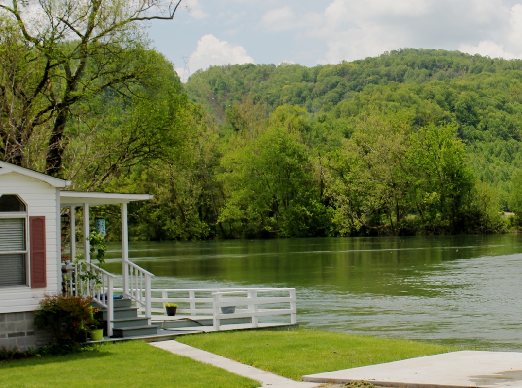
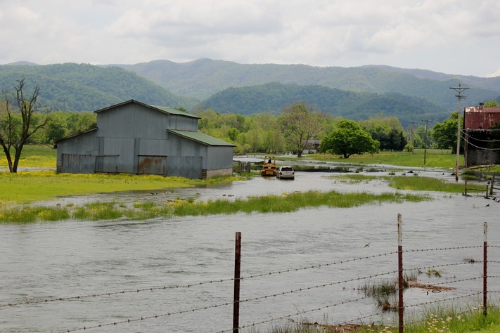
The additional water volume flowing into the Wilbur lake has caused some concerns within itself. The water must be released into the Watauga river as quickly as possible without causing the river to crest its banks.. Several homes and farms that border the river are just feet away from extensive water damage and others have already seen damage to basements, barns and land erosion.
The additional water volume flowing into the Wilbur lake has caused some concerns within itself. The water must be released into the Watauga river as quickly as possible without causing the river to crest its banks.. Several homes and farms that border the river are just feet away from extensive water damage and others have already seen damage to basements, barns and land erosion.
A flooded farm in Lynn Valley
It is predicted that without another substantial rain in the area, the lake's water level should be back to normal within a couple of weeks.
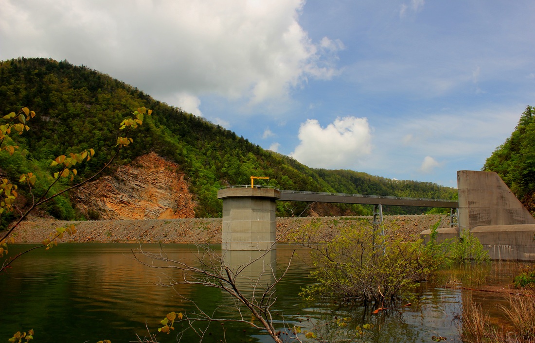
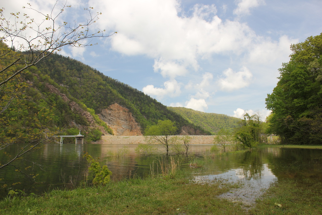
Flood gates open at Little Wilbur Dam
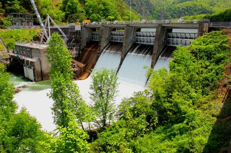
Three of the four flood gates on the Wilbur dam have been partially opened to allow water to rage from the top of the dam. This creates a beautiful man made waterfall of icy lake water. The spectacle has produced a large number of visitors to the lake including local residents as well as out of state guest. Some people are using this rare event to experience the beauty of our area for the first time. One such guest that had traveled from several states away approached me during one of my photo shoots. He stated that he and his wife were looking for the sandy beach that a friend had told him about. When he asked if I knew where the beach was, I pointed across the lake and with a grin on my face I just said "It's under there".
Impact on Watauga Lake Boat Docks
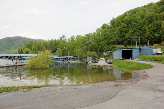
Lakeshore Boat Dock experiencing high water woes.
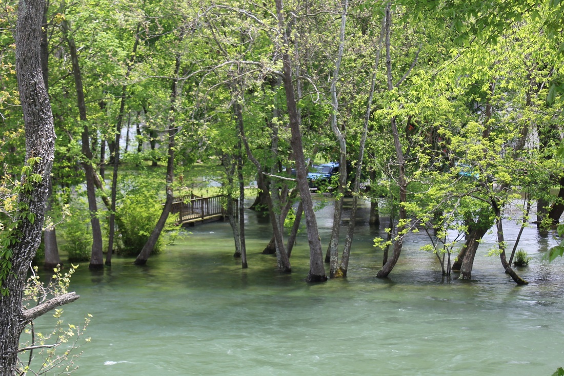
With the high waters combined with the speed in which the water level fluctuated, the boat docks have been working hard to sustain the boat docks on the lake. The dock along with the numerous boat slips and structures on the lake have to be adjusted daily when the water level is changing so drastically. Many of the docks have stationary camping trailers that are usually several feet from the lake but during this record breaking water height, some of those campers have sustained heavy water damage. Parking has also been greatly reduced at the docks as seen in the photo above. Many of the boat docks that can not be adjusted are now so far out into the lake that no catwalks are available. Owners wishing to access their boats must be ferried to the slips by dock attendants.
Day Recreation at Watauga Lake Impacted by High Waters
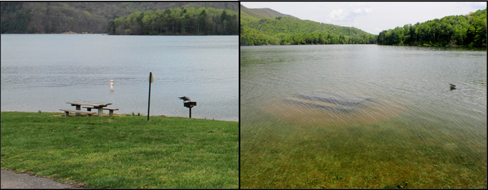
Rat Branch Boat Ramp with Dam in background
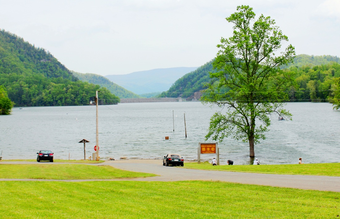
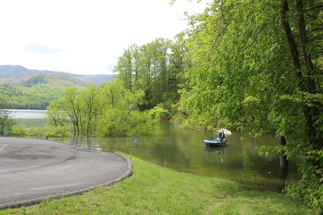
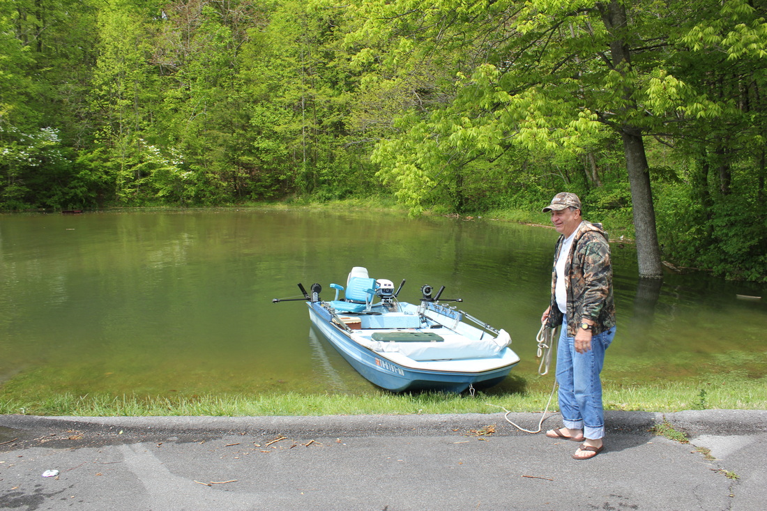
Many of the day recreation areas at the lake have been heavily affected by the high waters. All boat ramps have been either closed or moved to accommodate the high water. Shook branch has been closed and the Watauga Point has lost it's lower parking lot and the road around the point is under several feet of water. Many of the picnic tables are submerged and some have been tied to trees to keep them from floating away. According to TVA officials, the lake will be back to normal levels within two weeks and minimal permanent damage is expected.
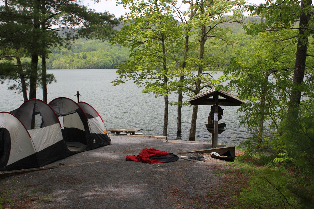
Camping at the Lake
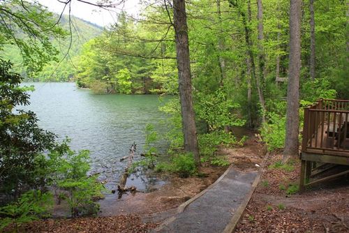
High waters have created lake side campsites at Carden's Bluff
Although several of the low lying campsites on Watauga lake have been affected by the high waters, for other campgrounds such as Carden's Bluff, the high lake levels have created lakefront sites that have never been available before. The only part of the campground that was affected by the water level is this one walk way on the west side of the camp ground. While taking these photos, my mind was flooded with some of my most cherished childhood memories which include camping in this very spot along with several other families which would camp near by. We would all set up camp in this part of the campground a few times every year.
Campers such as Carl Estep, Floyd Estep, Roy Estep, and Bill Hall along with their wives and children would spend several days with my family enjoying this beautiful lake and all it has to offer. A countless number of bluegill were caught in this very cove after we found bait worms under the leaves near by. All the children would play in the laurel thickets and we would occasionally find a turtle and sometimes a frog that I would always name "Little Willie", a name from a song my mother sang to me in my early years. And it was tradition to always pick a few laurel leaves and throw them into the fire and listen to them pop! I still can remember that distinct sound and smell.
Most of the adults mentioned above are no longer living and most of the children have moved away and are becoming senior adults themselves.
These childhood memories are so cherished by each of us that there is no doubt that I could mention camping at Carden's Bluff to any of them and they would smile and say "Hey, remember when...." and the stories would begin, unlocking a treasure chest of irreplaceable images and stories.
It is the hope of this website to encourage each of us to use the beauty and natural resources of Carter County to create our own memories with our families and friends. Be it camping, fishing, hiking, boating, rafting,or any other type of recreation, Carter County has more to offer than many realize. Most of the recreation in our area is either free or only a couple of dollars a day. Get out an make a memory today.